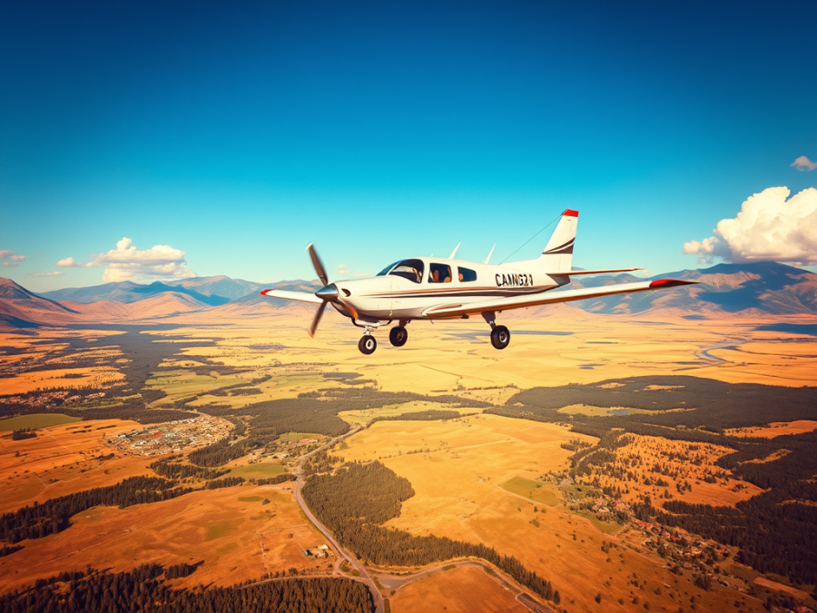
The TransCanada Highway crossed below me as I glanced at the Cav’s airspeed read out. We eased up through 80 mph with the RPM good and the plane climbing strongly. I smiled to myself and thought for the tenth time that morning how I love my airplane.
I was flying to lunch; lunch with my folks in Castlegar, BC. If I were driving this trip it’d take about 7 1/2 hours, and I’d definitely be late for lunch. But the Cav gets me there in about two hours and ten minutes. With my Cavalier I can fly to YCG, have lunch with my folks and then be back to Kirkby Field in about the same time it takes to drive one way.
I make this trip probably three times each summer and I thought I’d invite you along for this day’s flight.
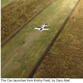
Things happen pretty quickly on a southbound departure from Kirkby’s. My first task was to get Calgary’s altimeter setting. The ATIS droned on until it revealed the secret I sought. By then I was crossing Glenmore Trail which put me clear of Kirkby’s ATF, but into Indus’.
I flipped to 123.2 and announced myself. A Cessna Bird Dog pilot announced his position in the circuit there and I soon had him in sight turning onto the downwind for his chosen runway.
I was grounding just over 120 knots as I zipped past the field where I learned to fly more than thirty years ago. From here I could also go higher, so I started a slow cruise climb to 5000′.
I crossed the Bow River, bid Indus goodbye and switched to Okotoks’ frequency. As I expected, there was nothing going on there, but I announced myself anyway. Next up was High River but since I was now at 6500′ and well to the east of the field, I only monitored the frequency. I also sent a quick text message to my dad with my ETA.
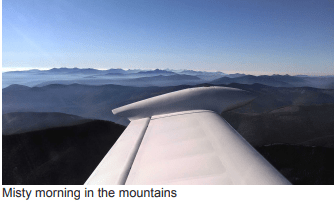
I was making excellent time this morning and the air was like glass. The Rockies grew closer as I continued to angle in toward the eastern face of the Livingstone Range. Some clouds were building further to the west, but that weather would be well north of my intentions that day. Still, it’d be foolish not to keep an eye on it as my flight progressed.
My flight planned route was direct to the south end of Chain Lakes, then south along Highway 22 to Highway 3 before turning west.
I wish I was the kind of guy who could be comfortable going direct over the mountains, but I just prefer mountain routes that allow first responders easy ground access should the unthinkable occur. It helps me avoid unneeded stress. After all, I do this stuff for fun. And for lunch, obviously.
As I coursed down the valley between the Livingstones and the Porcupine Hills, I drank in the beauty of the landscape. It’s pure cowboy country down there with ranches, foothills and forests. The grasses glowed golden in the September morning sun. The rolling, wind-burnished hills triggered pleasant memories of flying the Sacramento and Sonoma Valleys in California where some of the landscape is similar.
Radio frequency 126.7 was busy as it usually is on mornings like this. Helicopters announced they were training near Bragg Creek or heading directly into the mountains for survey work. Some guys in an Archer were messing around between Vulcan and High River at about 7500′. They were well behind me and thus of no concern.
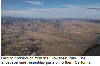
I have little shortcuts that I take when I fly to Castlegar. The first one is when I turn into the Crowsnest Pass. The VNC shows a pipeline marked on the map that cuts the corner from at the south end of the Livingstone Range into the Pass. I followed that and popped out over the debris field from the Frank Slide, which is an awesome sight, equally so from either the ground or the air.
I like to play a little mental game when I fly this route to Castlegar. I call it, “When Do I Pass Myself?” Essentially, I calculate where I would be at any given point along the route if I were driving from my house and compare that to where I actually am in my airplane. Then I figure out where I would be passing myself if I were driving. Usually, it’s in the Crowsnest. And I always make sure to wave to me as I go by. Sure, it’s silly but it passes the time.
I followed the Pass until I got to the narrowest part at Crowsnest Lake. At the west end of the lake, at the daunting and aptly named Mount Sentry, I took a left. Here, the Pass is at its narrowest and I felt like my wingtip could scrape the mountain. I rolled out headed southwest.
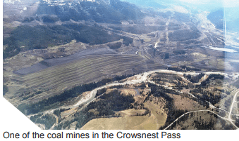
This area is studded with coal mines that contrast their carefully manicured black terraces against the jagged gray serrations of the Continental Divide. Sometimes I can see enormous dump trucks that from my altitude look like dinky toys. I couldn’t see any of them today, though.
Creek Road was my next checkpoint. I picked it up and followed it over a ridge into the Elk Valley. Fernie sat right below me as I made a slight heading correction to shoot for the ski hill on the valley’s west wall. There’s a nice little notch there that allowed me slip through into the much broader and longer Columbia Valley.
Assessment time, here. Did the weather ahead allow me to continue? I could see more cloud ahead, but it bottomed out a few hundred feet above the high peaks of the Purcell Range north of Creston. The layer was thin scattered to broken, but I could see enough above it to know that there was a good chance of some towering cumulus later today. It likely wouldn’t be good to dawdle for dessert at my dad’s.
I set my course to west-southwest. From the west side of Lake Koocanusa I followed another pipeline that was cut through the forest. It ends up at the south end of Moyie Lake. From there I picked up Highway 3 and headed toward Creston. There were a few sprinkles of rain that I encountered, which quickly dissipated and showed no signs of maturing beyond the virga stage.
Creston’s airport shares its frequency with Porthill’s strip. That’s the Idaho airstrip just a few feet over the US border where one can land and clear customs going in either direction. An American pilot was shooting circuits there and a King Air was inbound to Creston from the north. As I reached the east end of town I spotted the King Air well below me in his descent. I called him in sight, and he acknowledged.

Perhaps the most crucial part of the journey, terrain-wise and weather-wise lay just ahead. The west side of the Creston Valley greeted me with a wall of mountains that simply burst up from the valley floor. The highway leads to the top of the Kootenay Pass. At 5840′ ASL it’s one of the highest highways in Canada. Looking ahead into the pass from atop Creston I could easily see the other side and good weather beyond. I decided it was safe to continue.
I was at 8500′ going over the pass a few minutes later and I was scraping the bottom of the clouds there. Again, I could see worse weather to the north and was glad I didn’t route via St. Mary’s Pass west of Cranbrook. A little more rain fell here, but the road was dry, so I didn’t give it much thought. Besides, it was all downhill from here.
I was surprised at how smooth my ride had been to this point, especially over the Kootenay Pass. It’s usually at least a little bumpy there, but today was charmingly calm. I crossed my fingers and hoped for similar serenity on my return flight in a few hours’ time.
Once over the pass and turned north for the Salmo area, I started to descend slowly. In a few more miles I’d have to drop into the valley at Castlegar and land at an elevation of 1600 feet. I silently chided myself for not bringing any chewing gum.
Once west of Salmo I called up the FSS at Castlegar. Through crackly, but rapidly improving reception, the specialist offered his wisdom on the current conditions, and we agreed that I’d be landing on runway 33.
The normal timing on my mountain lunch flights usually sees me arriving at the same time as the jazz flight from Calgary, or just ahead of it. There was no sign of the Dash 8 now so one of us was obviously early or late. The only other traffic was a 172 inbound from the north.
I stretched my descent well to the north to kill as much height as I could, and further translated that into a long left downwind over the centre of town. I turned onto the left base and smiled at the perverse little thrill of flying straight toward the side of a mountain. My wife found it rather disconcerting the first time we made this trip together. My landing was none too magical, but I was down safely and looking forward to some food.
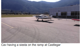
Fuel had to come first, though. Brian M., Brilliant aviation’s terrific lineman, appeared as I rolled up to the pumps. Brian is a former railway man from Calgary, and we’ve become friends over the past few years because of my flights to Castlegar. We got ourselves caught up as we fuelled the Cav, and then I rolled it over to a corner of the ramp for a siesta until I returned.
Lunch with my folks was as enjoyable as it always is and less than two hours after I landed, I was back at the Cav and checking the oil. I filed my flight plan for the exact opposite of my route outbound and was soon in the air climbing steeply to clear the mountains southeast of the field.
The Cav’s climb rate, which is well over a thousand feet per minute, always brings me great joy, especially climbing out of the deep, steep valley where Castlegar sits. About six minutes after breaking ground, I was through 7000′ at the edge of the zone and thanking the FSS man for his help.

Good thing I left YCG when I did. The clouds in the Kootenay Pass were a thousand feet lower than they were in the morning, and more were closing in from the north. I set my eastbound altitude for 7500′ and had to dodge only a few of them until I popped out over the Creston Valley.

It was pretty smooth sailing on the backtrack, but things got a bit bumpy in the Crowsnest, as is usual there in the afternoon. But once I cleared the Livingstone Range and turned north, the air smoothed out nicely.
The downhill run past High River, Okotoks and Indus was a pleasant ride, and I coasted into the circuit at Kirkby’s not two hours after getting airborne. My landing again lacked any magic, but I did make the taxiway turnoff.

As much as I love my Cavalier, and the adventures we have, I love it even more for because it allows me the chance to spend more time with my family. Because of the Cav’s speed and utility, I get to see my folks more often each year than I otherwise would. Of all the reasons I can think of for owning an airplane, that one alone ranks right near the top.
Oh, and lunch. I get to fly to lunch.
